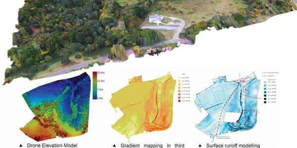
Aerial Mapping and LIDAR Surveying

We are a leading provider of high-resolution aerial mapping solutions using state-of-the-art drone technology. Our team of experienced pilots and geospatial experts can help you obtain the data you need to make informed decisions about your property, infrastructure, or environment.

Our Advantages
We stand out from the competition because of our:
- High-resolution data: Our drones can capture high-resolution images that provide detailed information about your property or infrastructure.
- Quick turnaround time: We can provide you with the aerial maps and data you need in a matter of days, not weeks.
- Cost-effective: Compared to traditional aerial mapping methods, our drone services are much more cost-effective.
- Experienced team: Our team of experienced pilots and geospatial experts ensures that you receive high-quality results every time.

We offer a range of lidar drone services including:
• Topographic Surveying: Obtain accurate and detailed 3D models of your property or infrastructure for design and planning purposes.
• Volumetric Surveying: Determine the volume of stockpiles, pits, or other land features with high accuracy.
• Forest Mapping: Map and measure the density, height, and biomass of forests to support sustainable forest management.
• Construction Surveying: Monitor the progress of construction sites and identify potential issues before they become problems.
We are not surveyors, we are a data service provider. Skyview often partners with surveyors and civil engineers to enhance the efficiency of their projects.
Skyview Industrial, LLC
Nashville - Birmingham - Atlanta - Jacksonville - Louisville - St. Louis - Charlotte - Kansas City - Little Rock
Copyright © 2023 Skyview Industrial, LLC - All Rights Reserved.
